-
Can We Forecast Where Water Conflicts Are Likely to Occur?
Many of the world’s freshwater systems reach across national boundaries, and growing demands combined with supply constraints may lead to increased potential for international water conflicts. If that’s the case, which international river basins are most at risk of conflict or, conversely, which are most prone to cooperation? What are the factors that increase or decrease conflict risk?
Growing demands combined with supply constraints may lead to increased potential for international water conflictsThe scientific literature on international water politics offers a wealth of case studies on individual river basins and an increasing number of larger-scale comparisons of many international freshwater catchments.
The latter work in particular offers a reasonably good basis for moving one step further, that is, from explanations of international water conflict in the past to predictions about which areas of the world are most prone to water conflicts in the future.
Basins at Risks
Building on new data on international river basins and conflict events, we revisited earlier research on the basins at risk of conflict and developed a prediction and forecasting approach for international river basin conflicts.
Whereas an earlier study by Yoffe, Wolf, and colleagues identified 29 basins at risk, our work, recently published in Global Environmental Politics, identifies 44 such river basins (see map). Only six basins simultaneously appear in the earlier and the new list: the Asi/Orontes, Cross, Han, Indus, Ob, and Tigris-Euphrates.
Note, however, that none of the river basins identified are likely to experience a “water war,” in the sense of an armed conflict over water. Instead, we expect conflicts to materialize primarily in the form of political tensions.

Creating a Forward-Looking Methodology
How did we arrive at these findings? The most popular prospective analysis to date, the Basins at Risk Project by Yoffe, Wolf, et al., was published more than 10 years ago (2003). It relied on the Transboundary Freshwater Dispute Database, which codes water-related events (conflict and cooperation) in most international river basins over a long period of time on a scale ranging from highly conflictive to highly cooperative events. Yoffe et al. correlated this scale with a large set of factors that might influence conflict risk or chances of cooperation. Based on this very simple statistical approach (so-called bivariate regression analysis) to explaining past water conflict and cooperation events, they then extrapolated from the past and identified those international river basins that appeared particularly risk-prone in the coming years.
Forecasting must be founded on explanatory models that can accurately account for the past
Prediction and forecasting must be founded on explanatory models that can accurately account for water conflict and cooperation in the past. And they should rely on state-of-the-art statistical prediction and forecasting methods when moving from the past to the future. The Yoffe et al. study was, in this respect, ahead of its time, since large-scale statistical research on international river basin conflict and cooperation was still in its infancy in 2003.
To fill this gap, we first constructed an explanatory model of past international river basin conflict and cooperation. We then used statistical methods to evaluate the predictive power of particular explanatory factors – for example income levels of countries, political system characteristics, and river geography. Finally, we then moved to forecasting which river basins might be more conflict-prone in the future.
New Risk Factors
Differences in methodology and empirical data resulted not only in differences concerning basins at risk, but also in predictors. Yoffe et al. highlighted high population density, low GDP per capita, overall unfriendly relations between riparian countries, politically active minority groups, proposed large dams or other water development projects, and limited or no freshwater treaties as being particularly important.
Interestingly, our study did not identify any of these factors as robust predictors for conflict. Some of the usual suspects, for instance income levels or membership in international organizations, turned out to be poor predictors. In a related paper published in Political Geography we also found that the geographic setting, and in particular power asymmetries between upstream and downstream countries, are unlikely to be a significant cause of water conflict.
Instead, our work finds the effects of regime type (level of democracy), the nature of riparian countries’ legal systems, precipitation levels, geographic contiguity, and the number of riparian states are most important to determining conflict risk.
Predictive Power
Perhaps most importantly, forecasting offers more relevant advice to policymakers
This work suggests we can, in a scientifically meaningful way, forecast where international water conflicts are more likely to occur, even though we must remain aware that forecasts are always associated with considerable uncertainty. This uncertainty stems from the fact that explanatory models of past conflict, on which forecasts rely, are imperfect, and that unforeseen conditions may pop up in the future.
We believe, however, that moving from explaining and analyzing events in the past to prediction and forecasting is critical. It complements the former by allowing us to discriminate among explanatory factors according to their predictive power, and perhaps most importantly, forecasting offers more relevant advice to policymakers who will certainly face mounting water challenges in the years to come.
Thomas Bernauer is a professor of international politics at ETH Zurich, Switzerland. Tobias Böhmelt is a lecturer at the University of Essex, United Kingdom.
Sources: Global Environmental Politics, The International Studies Encyclopedia, Political Geography, Social Science Research Network, Transboundary Freshwater Dispute Database, Wolf et al. (2003), Yoffe (2001).
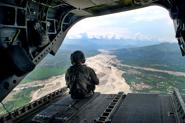
Photo Credit: A U.S. Army helicopter surveys flood damage in Pakistan, August 2010, courtesy of Monica K. Smith/U.S. Army. Map: Used with permission courtesy of Thomas Bernauer.
 A Publication of the Stimson Center.


